|
|
Mutterbergalm to Dresdner Hütte
|
|
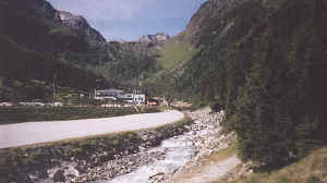
The start of the walk at Mutterbergalm
Using our Stubai Karte (5 day bus and cable car ticket) we took the bus to Mutterbergalm (1721m) for the Stubaigletscherbahn valley station. We walked slightly downhill to join a path sign-posted Mutterberger See 2 ½ hours. This climbed quite steeply through woods and then onto the heath land of the Kastäler. Taking the right hand path at an un-signposted junction the track climbs more steeply up to the Hohe Grube at about 2400m.
|
|
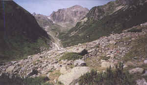
The lower part of the Wilde Grube with the Vorderer Daunkopf at the head of the valley
|
|
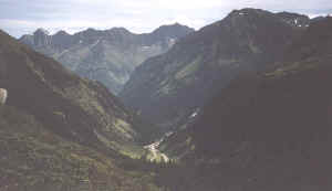
Looking down into the Stubaital with the Mairspitze
The Schafnock and Gammspitze rise to about 3100m to the north. Several small
lakes were passed, some partly dried up. From Hohe Grube there is a tremendous
panorama of all the Stubaital 3000m mountains and their glaciers, the highest
being the Stubaier Wildspitze to the west at 3341m.
|
|
The Hohe Grube with the Nordlicher Daunkogel and the Mutterberger Seespitze in the background.
The path then drops slightly to meet the Stubaier Hohenweg path from the Neue Regensburger Hütte. The times on the signposts here were a little confusing as we had expected about 2 hours to our destination at the Dresdner Hütte via the Mutterberger See. The signposted suggested 2 ½ hours by the direct path which avoids the ascent to the lake, whilst the ascent to the lake was shown as ½ hour. After some hesitation we climbed up to the lake, which has a magnificent setting in a corrie and is obviously very deep. The climb, both up to, and down from the lake at 2483m was over fairly rocky ground.
|
|
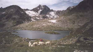
The Mutterberger See and the 3302m Mutterberger Seespitze.
Once we had rejoined the main path it led fairly gently down hill beneath the
Vorderer Daunkopf to join the vehicle track from Mutterbergalm to the Eisgrat
cable car station.
|
|
The Wilde Grube from Mutterberger See. From left to right the Schaufelspitze (3332M), Srubaier Wildspitze (3341m) and the Daunkogel (3301m).
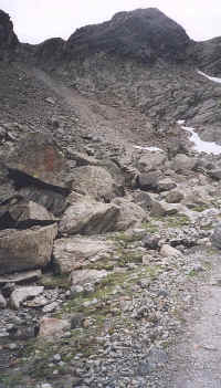
Here the signpost suggested 1 hour to Dresdner Hütte so we were back on schedule. Austrian footpath signs are clearly not always consistent! From a low point at 2250m the vehicle track climbed quite steeply up into the Wilde Gruben and at about 2400m a narrow path led off to climb very steeply up to a coll. About 100m of this was across sloping rock slabs with a protective wire cable, which has to be used. None of the guides referred to this section and Stephen muttered more than a few swear words on seeing it. Nevertheless it was perfectly safe, if a little awkward to cross.
|
|
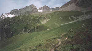
The path from the Wilde Grube over the col to the Dresdner Hutte
On reaching the coll, at about 2500m, the path then descends quite easily over
grass and stones to the Dresdner Hütte at 2308m and the Fernau middle station of
the Eisgrat gondola cable car. Our times from Mutterbergalm to the Dresdner
Hütte precisely matched the expected 4 ½ hours. Nevertheless at the hut we saw
two signposts within 10 metres of each other with ½ hour difference between them
to the Mutterberger See! Clearly accurate timings are not a feature in this
area.
|
|
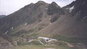
The Grosser Trögler from above the Dresdner Hütte and the Fernau Mittelstation cable car.