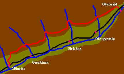
Gommer
Höhenweg
We decided to walk the Gommer
Höhenweg in two parts, working outwards
from Münster in both directions, on separate days. One of the useful features
of this walk is that you can descend into the valley at many points and catch a
train from one of the village stations if you decide to cut short the walk.

Click on the images above
to enlarge.
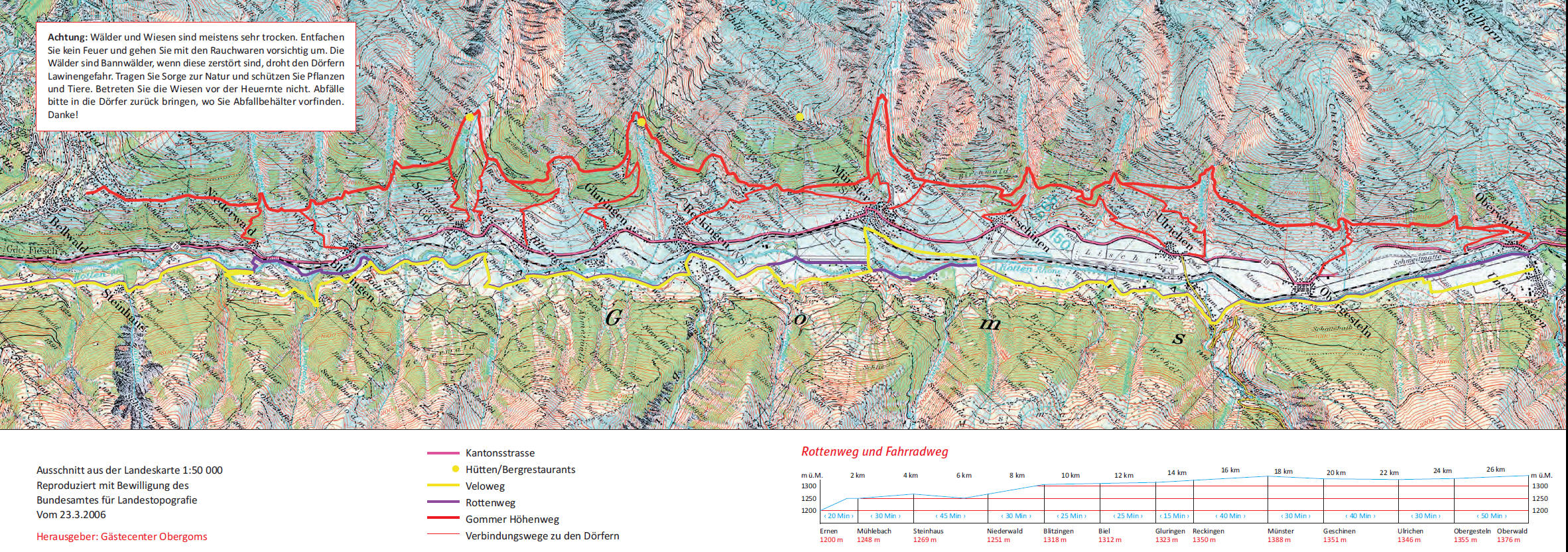
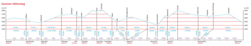
The Gommer
Höhenweg
is shown in red on the map
Day 1 Münster to Oberwald
The
time from Munster to Oberwald is about 4 hours. Leaving the railway station (1360m) the Gommer Höhenweg
signs point uphill through the village to Löüwene
(1538m) passing the dam built after the disastrous floods in 1987.
Click
on photos for larger image and then use back button to return to this
page.
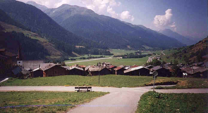
Looking
back to Münster at the start of the walk on day 1
The path
continues north-eastwards through larch forests but with plenty of gaps allowing
views across the valley of the Rotten Rhone. The path crosses no less than 5
major streams between Münster and Oberwald. At each valley the path drops to a
bridge and then climbs out of the valley. One or two of these sections are quite
steep and a little exposed on the mountainside but ropes are provided on these
parts of the trail.
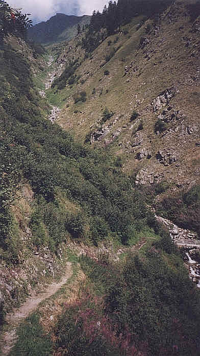
The path descends to one of the many streams that it
crosses
The path
is a mixture of track and forest vehicle lanes. Above Nessel (about half way)
the summit of the walk is reached at 1712m with a panoramic photo board and a
convenient bench – ideal for lunch. There is a magnificent view up the valley
to the Neunfenpass and the snow capped mountains on the Swiss/ Italian border.
Looking towards Oberwald from near the Milibach
The path
gradually falls to Hostette at 1535 m. After crossing the Milibach a path goes
off to the Grimselpass but the path to Oberwald continues through forests to
eventually reach Oberwald.
Day
2 Münster to Bellwald
We took the train
again to Münster, this time leaving the village in a south westerly direction,
on a paved lane which climbed steadily to reach a crossing point over the
Reckingerbach at about 1760m Here there is a most unusual mountain restaurant by
the stream – there are garden gnomes, computer produced jokes on the walls, a
small marquee and a guardian who insisted we wrote in his visitors’ book
From here
the path crosses a succession of streams, the Walibach, Hilpersbach, Wilerbach
and Schwarzer Brunnen, most of which involved fairly steep ascents and descents
and in the heat of the summer of 2003, with temperatures in the upper 30s,
extremely tiring. The altitude of the path descends to a low point of 1371m.
Then the path climbs again up to 1622m at Obermatta before gradually descending
to the outskirts of Bellwald.
The path descends to cross thestream in
the Bieligertal
Then
there is a 15 minute walk downhill through the village to the cable car station
at 1559m. From here the Risihorn, Fieschergletscher and Eggishorn tower above
the village. The walk had taken about 5 hours with a height gain of 856m and a
height loss of 657m. The cable car only takes 6 people so walkers are advised to
leave plenty of time to make their connection at the railway station at
Furgangen.
The delightful church at Bellwald with the
Fieschergletscher in the background