
Meall Odhar
The map above shows my track taken from my Spot personal tracker. Click on the top right corner to see a larger map.
For my first walk of 2024 in Scotland I decided to climb the Graham Meall Odhar. It's 656m above sea level although with a start from Tyndrum Lower station at 250m it's not a great ascent.
I travelled up from Glasgow by train to Tyndrum.
Immediately after crossing the railway near the station there is signpost for the Cattle Creep Trail which gives access to the track up Meall Odhar.

It's a good path which runs parallel with the railway....

....and has good views of the Corbett Beinn Odhar

The path enters woodland...

.....before reaching a ford over a jumble of scree.

This is looking down from the ford showing the damage done by water erosion. The cattle creep bridge can be seen in the distance under the railway.

A feature of this walk are the remains of the Tyndrum lead mining industry. This is one of several fenced off areas for the mine entrances.

There's another short section through the woods before reaching..

.....the bottom of the incline from the mine workings. The ore was brought down hill on a wooden shute.

As I was walking I heard the noise of a freight train approaching Upper Tyndrum station on the line from Fort William. This was a train of empty alumina tank wagons returning from the smelter at Fort William to Blythe. It runs three times a week so what were the odds on me seeing it?
The Tyndrum lead mining industry started in 1741 when a seam of lead was discovered. The ore was smelted in Tyndrum at the bottom of the incline. The mines continued to be worked until the 1920s but frequently made heavy losses and passed between different owners.

There is a path through the scree formed by the mine waste.
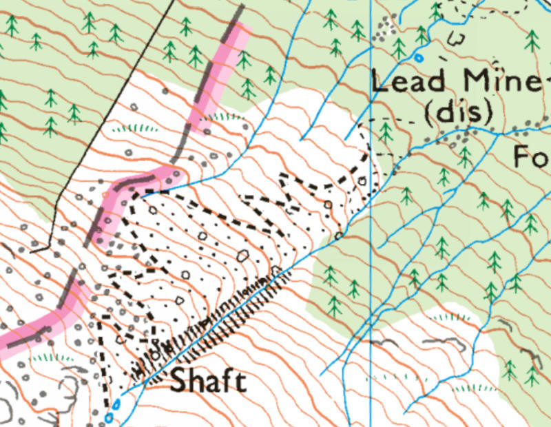 |
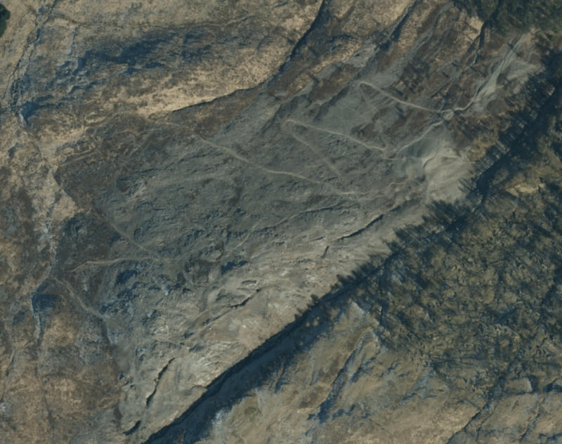 |
Map and aerial view of the track through the mine waste.

In places it was hard to be sure where the track went, especially so going uphill when it wasn't obvious at times....

.....but after several wrong turns I managed to get up to the upper levels.

Looking back down to the village of Tyndrum.

Climbing the zig zags....

....and I was wondering whether it would be better to come downhill on the grass.

At the top of the scree the track becomes less rocky....

....and I get a view of the Munro Ben Challum.

At the top of the scree the path goes through the remains of a building...

....and there is a view of the Munro Ben Dorain peeping above the hill over to the left.

The walk now turns into a proper hill walk, although there are a few areas which are fenced off around mine workings.

There is what appears to be a small reservoir behind a stone wall, presumably a remnant from the mine era.

Ahead across the moor is the cairn on Sron nan Colan (590m)

Looking from the cairn with the summit of Meall Odhar (above the forestry plantation) about a mile away.

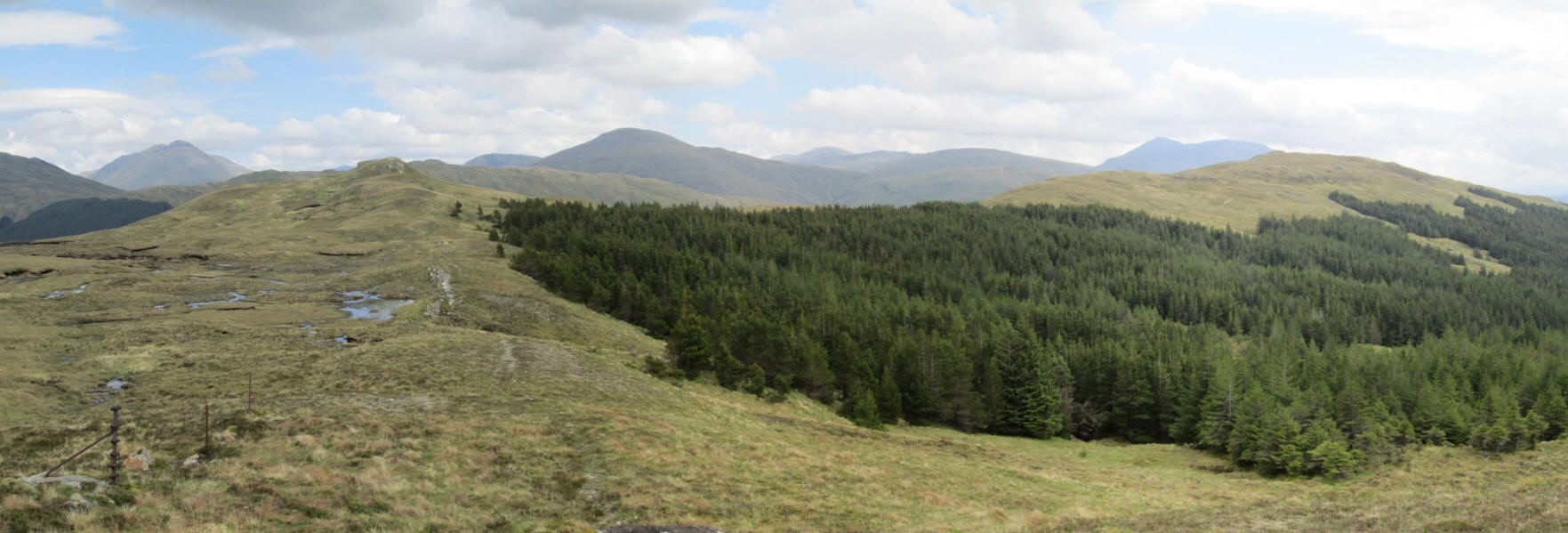
From the cairn I aim for the right hand side of the forest....

.....across pleasant easy walking grass...

.....where a faint track can be followed.

Ahead is Drochaid an Droma but there's no need to climb that as I drop down hill slightly to the trees.

There's a small lochan that drains into the Allt nan Sae stream with a curious stone wall - was this some sort of shelter?

Like several hills in this area there is a dyke of rock that stands out on the hillside. Following this will lead me towards the summit.
A panoramic view looking back. Click on the photo to show it full size.

Looking south east towards Crianlarich with the Munros Ben More and Stob Binnein

Climbing up by the rock dyke.....

....the grassy top of the hill is reached....

...but there are still a few hundred metres to the summit.

There is a tiny pile of stones at summit. I had taken two and a half hours from the station rather than the 1 hour and 45 minutes I had expected - climbing through the scree really slowed progress.
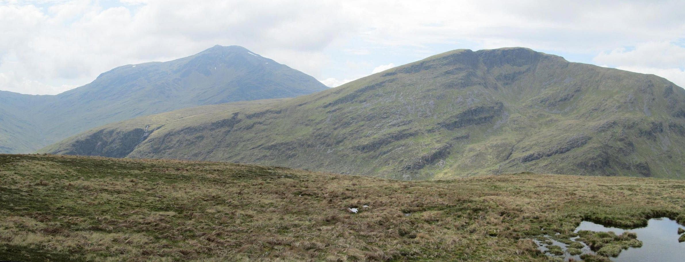
I had a lazy lunch at the summit in the sun had this view in front of me looking South West. On the left is the Munro Ben Lui and directly ahead is the Corbett Beinn Chuirn. Click on the photo to see a full sized image.

To the south are two more Munros - Ben Dubhchraig on the left and Ben Oss on the right.
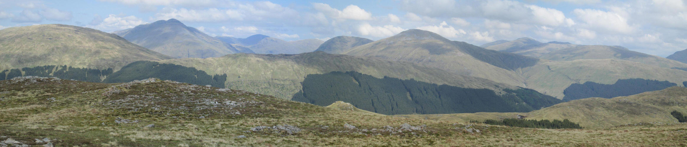
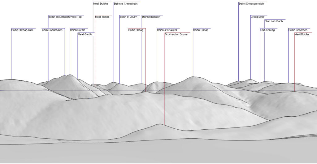
A panoramic view looking north. The diagram below shows the names of the hills. Click on the image to see it full size.
Panorama created using this website.
https://www.udeuschle.de/panoramas/makepanoramas_en.htm

Looking west towards the Munros of Ben Cruachan on the left and Ben Eunaich on the right.

On the way back down the hill Ben More and Stob Binnein are seen in a better light.
Progress was better going down the track through the mine scree as the track was more obvious taking just under two hours. I was back in plenty of time for the afternoon train to Glasgow.