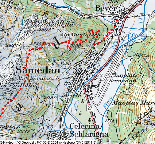
Bever
or Samedan to Maloja via the Via Engiadina
Day 1 - Bever to Sils Baselgia
The normal way to walk this section of the Via Engiadina appears to be to stop at the Signalbahn cable car station above St. Moritz and resume from the same place. This makes two day’s walk of about 5h to 5h 30m. However, the circumstances I found myself in meant that I needed to get much further on than the Signalbahn on the first day, so that I could have a short walk on the second day. I therefore decided to attempt to walk from Bever to Sils Baselgia on the first day, and then continue to Maloja on the morning of the second day.
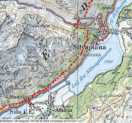
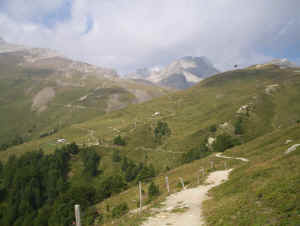
Leaving Bever I omitted the loop around the town in favour of joining the Via Engiadina just across the river. The track rises through woods to reach the outskirts of Samedan at Muntarüsch (1723m). The climb then begins with a vengeance as the forest track climbs in loops steadily to the farm at Muntatsch (2186m).
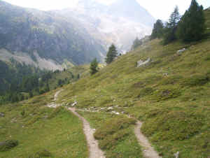
The path from Muntatsch
As the path rises higher there are increasingly spectacular views of the Bernina mountains. Beyond the farm the track turns into a delightful path which loops its way around the slopes of Piz Padella (2856m). There’s a sudden right turn at a junction as the path makes its way up to the high point of the walk at Munt de la Bes-cha (2489m) underneath some cliffs.
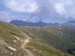
Looking back towards Muntatsch with the mountains near the Albula Pass in the background.
There’s then a steady,
and occasionally very steep fall down to the gondola cable car station at
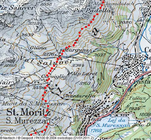
Marguns, which I reached after 3h from Bever, about half an hour faster than
earlier signs indicated. Having dropped down to 2273m the walker is then faced
with an unremittingly steep and somewhat soul-destroying climb uphill, on a rough
track, to the Corviglia funicular station reached 3h 30m from Bever. The view of
the spectacular range of 3000m mountains in the background does help somewhat
even if the foreground is dominated by winter sports equipment!
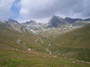
The 3000m mountains behind Marguns
After a well deserved break at the restaurant at Corviglia, I decided that it would be possible to reach my planned destination in a reasonable time. The Via Engiadina drops down the rough vehicle track almost to the Signalbahn station. Thankfully there are several sections where there’s a footpath instead.
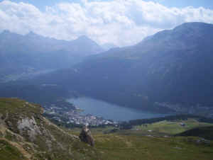
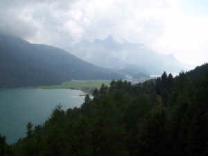
St Moritz and its lake
The path then
heads off towards Alp Suvretta looping around the slopes of Piz Nair, with its
cable car going to the very top! At the farm buildings the path drops down,
leaves the path to the Suvretta Pass and doubles back on the other side of the Ova
da Suvretta stream.
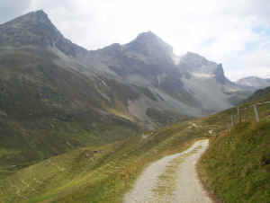
The path to Alp Suvretta
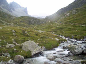
By the Ova da Suvretta look towards the Suvretta Pass
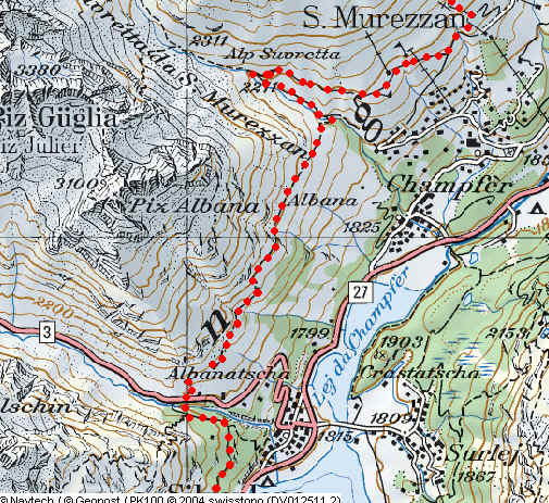
Beyond here the path climbs around the lower slopes of Piz Julier and becomes increasingly stony as it crosses small boulder fields. The views over St. Moritz and towards Piz Corvatsch (3295m) with its glaciers become increasingly spectacular. To add further interest there are the remains of World War One fortifications built to protect the Julier Pass road.
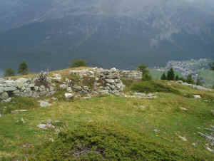
World War One fortifications above the Julier Pass
Dropping down to the Julier Pass
The path now drops down a staircase to the Julier Pass road, which runs between Silvaplana and Chur, before joining a forest path, falling gently down all the way to Sils/Segl Baselgia. The time from Bever was exactly seven hours including two short breaks.
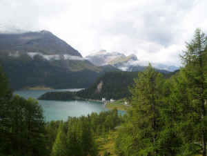
Lej da Silvaplauna
Day
2 - Sils Baselgia to Majola via the Via Engiadina
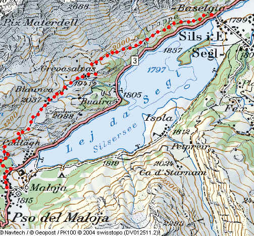
The following day I rejoined the Via Engiadina at Sils Baselgia. It is a steady climb through woods and over a series of rocky sections with super views over the lake and the mountains beyond.
The Lej da Segl
The path then drops steeply underneath some cliffs to reach the hamlet of Grevasalvas, which was used for the filming of one of the many versions of “Heidi”. A farm track is followed up hill to another small hamlet at Blaunca before heading off across meadows towards Maloja.
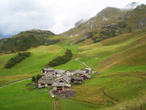
Grevasalvas
The final
section took place in rain with a thunderstorm rolling around the surrounding
mountains, giving a suitably dramatic ending to the walk. Finally there’s a steep,
rocky and in places a little tricky descent into Maloja – for me the second
ending to our walk across the Engadine.
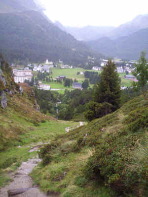
Maloja in the rain
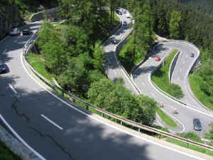
That afternoon Fran joined me for a Post bus journey along the Passo del Maloja road to Chiavenna. If you get as far as Maloja take this journey or you won’t appreciate that Maloja is actually situated at the top of an almost sheer valley wall at the head of the Val Bregaglia. We lost count of the number of hair pin bends. It really is an incredible journey and unusual in that it's the only pass in the Alps with only one ramp up to the summit.